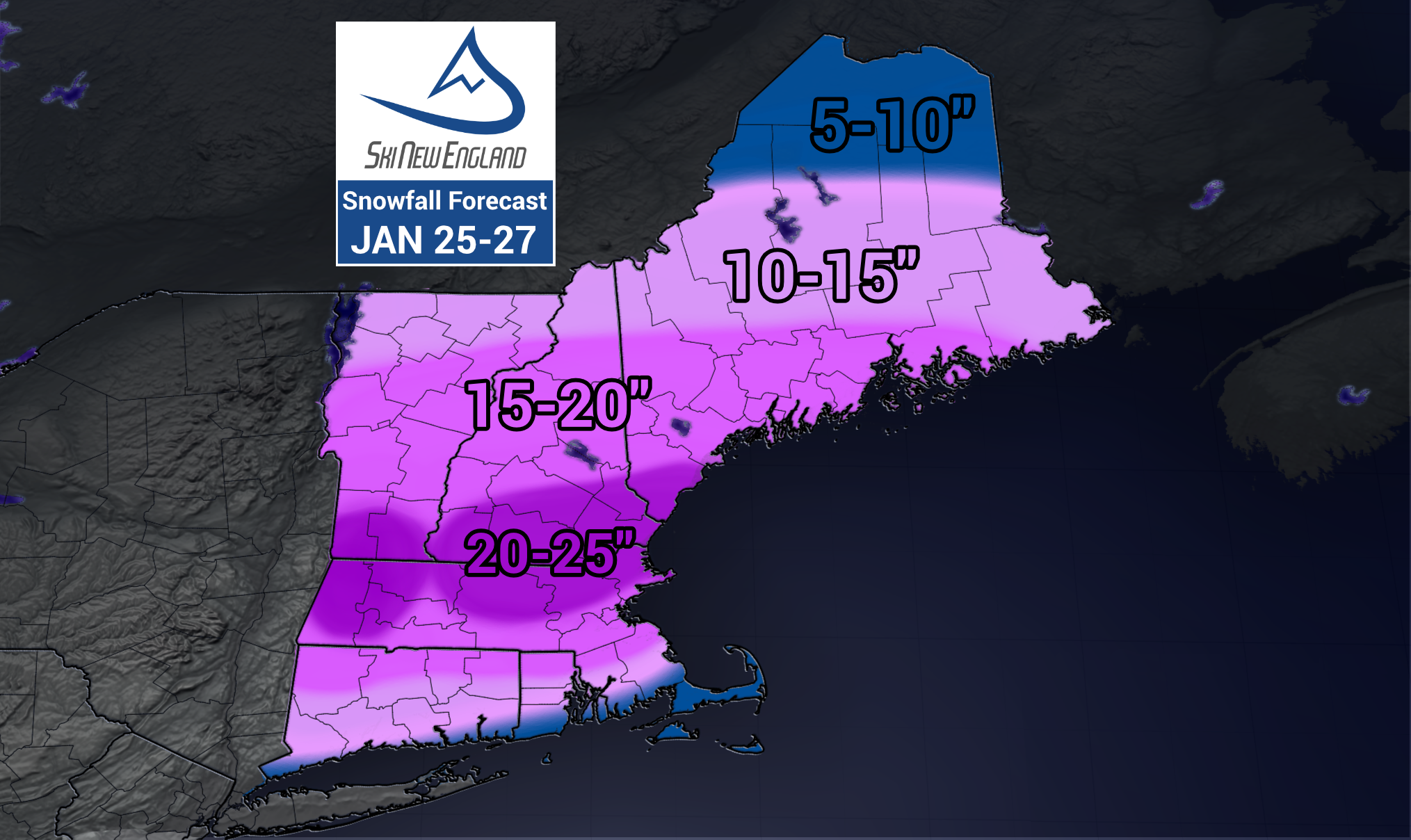
A winter storm is expected to move into New England Sunday, bringing with it up to two feet of fresh snow for the region.

The National Weather Service has issued Winter Storm Warnings and Winter Storm Watches for nearly all of New England as the storm moves in.

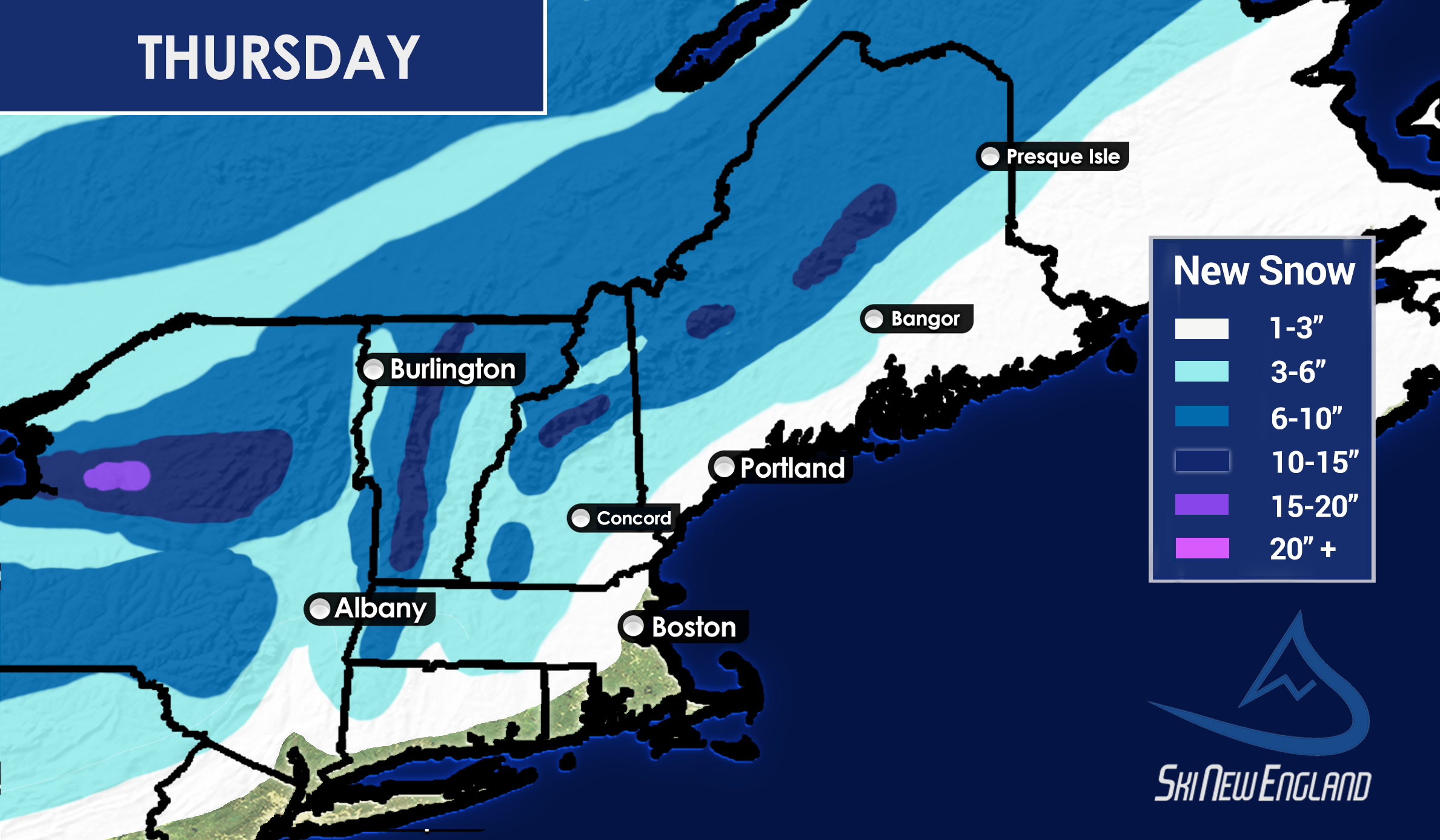
Snow starts falling as early as mid-morning Sunday for parts of Connecticut, but by Sunday evening it will overspread most of New England with heavier bands of snow showing up.
The highest amounts are expected in southern and central parts of New England, but even locations farther away from the center of the storm could see at least a foot of snow.
A few resorts in the sweet spot of picking up the most snow from the storm are…
Berkshire East, Bousquet, Catamount, Crotched, Jiminy Peak, Magic Mountain, McIntyre, Mount Snow, Nashoba Valley, Ski Butternut, Ski Bradford, Ski Ward, Stratton, and Wachusett.
If you plan on skiing Monday, make sure you’re at your skiing destination as driving during the storm will be challenging. Snow is expected to continue for most of the day Monday but snowfall rates will drop by the afternoon.
The rest of the week behind the storm is expected to be cold, with wind chills staying below zero most of the week. Some of the higher peaks, above 3000ft, could see wind chills dip to 20 below at times so wear your warmest gear. -AJ